Lewes History Group
Discovering historical Lewes
Skip to content
Home
About
Talks & Visits
Research Meetings and Courses
Membership
Projects
The Lewes Street Stories Initiative
Lewes Maps Project
Caring for the Lewes Poor
Cement and lime works on the River Ouse
St John Street Then and Now !
Research Resources
Publications
Bulletins
Contact us
←
Lewes Maps Project
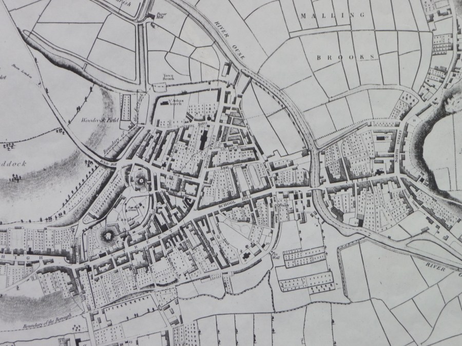
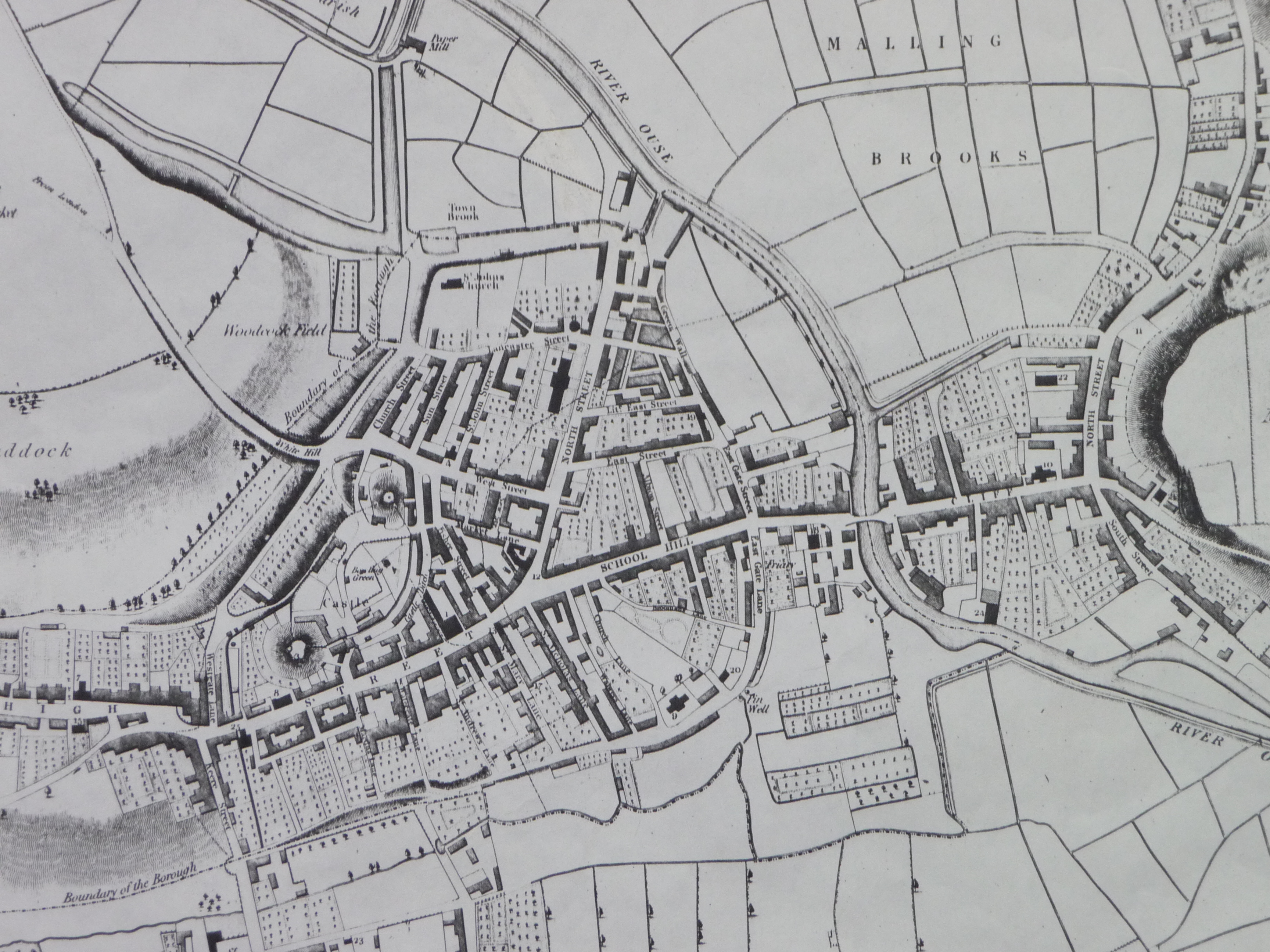
Lewes 1824 (detail) – drawn by W Figg
By
Admin
|
Published
February 22, 2011
|
Full size is
3456 × 2592
pixels
1799 Edwards town plan SAS archive
Lewes map 1824 (detail), by W. Figg (By kind permission of Lewes Library)
Like
Loading...
Bookmark the
permalink
.
Subscribe
Subscribed
Lewes History Group
Join 332 other subscribers
Sign me up
Already have a WordPress.com account?
Log in now.
Lewes History Group
Subscribe
Subscribed
Sign up
Log in
Copy shortlink
Report this content
View post in Reader
Manage subscriptions
Collapse this bar
%d

