South Street History > The River and Local Industries
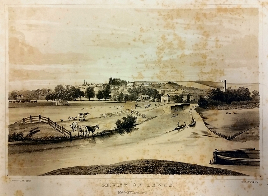
The river Ouse has been an important source of trade and employment through most of South Street’s history. Cargoes included stone from Caen (used to build the Priory), Wealden iron, wool, coal and much timber.
In the 18th century records show a number of bargemen living in South Street as the river continued to be an important source of trade. However, the river had become sluggish, with the tidal flow hardly reaching the Cliffe Bridge.
A report in 1768 by John Smeaton, engineer, provided plenty of information; including that there was serious flooding at high spring tides, the banks were not high enough and the outfalls of sluices were not low enough. The river was too crooked and obstructions narrowed the flow.
Some work was undertaken and in 1791 the Lower Ouse Navigation Act led to developments at Newhaven which improved the flow up river. A navigable channel was therefore achieved along with better drainage of the Brooklands.
Along with a further Act in 1794 to improve navigation, it also increased the tidal rise and fall up to Lewes and the Cliffe. Before 1790 this had been barely a foot but now tidal variation could be as much as 11ft at spring tides.
The river works included making a straight canal cut on the Ouse alongside South Street (the Cliffe Cut). This created an island on which lies the present boat club, and the channel on the South Street side, the original course of the river, became a backwater with a wharf and ship building.
The making of the Cliffe Cut led to an expansion of the barge trade. In 1810 there were 29 barges working between Lewes and Newhaven and a further 10 plied their trade upriver. The censuses show that many bargemen lived on the street and the barge masters also resided there, often owning several properties which they tenanted.
Ship building was another trade to expand. Between 1838 and 1866 sea-going ships, including the Lewes Castle and The Wallands, were built in yards north of the Cliffe Bridge, launched sideways, and then floated down under the Cliffe Bridge to wharfs on South Street for fitting out. One of these yards was Higham’s, located on the backwater formed by the original course of the river after the Cut was made and is now the site of houses 118-124.
Click image to enlarge
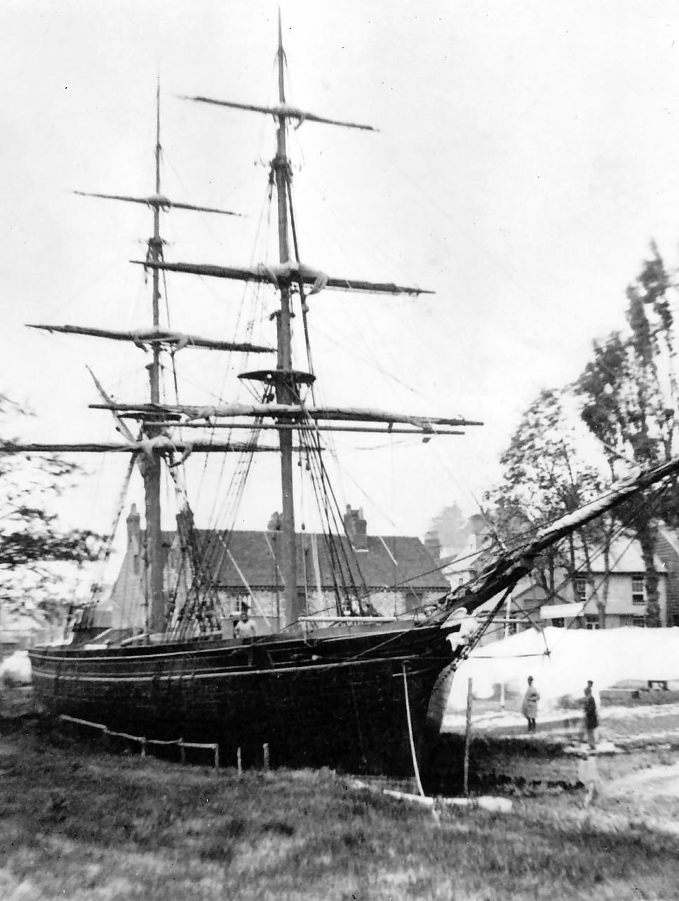
A fine photograph, widely reproduced, shows a ship in Higham’s yard. It has been suggested that the ship is the coal brig, Halifax, undergoing repairs in 1839 but such a photo could not have been taken that early and is likely to be after 1850/60. It has been suggested that this was the Lewes Lass built in 1850, which was a snow-rigged vessel with the figurehead of an angel. However most evidence points to the ship as the Eagle, a ‘snow’, with the figurehead of an eagle, built in 1863.
The Keep has a copy of this photograph, labelled as ‘the coal brig Halifax undergoing repairs at Higham’s Wharf, South Street’ giving a Reeves reference number.
It was copied from a half plate negative by Reeves in the 19th century.
The Island
The Cliffe Cut formed an island between it and the original course of the river. Known to locals in the 20th century as ‘The Orchard’ it was accessed by two footbridges, clearly seen on the 1938 OS map. One bridge was accessed alongside number 82, now the entrance to the Boat Club.
In 1860 the Old Ship pub (now number 49) advertised “delightful pleasure gardens and brook land immediately opposite, situated on an island, accessible by a drawbridge over the splendid River Ouse, abounding in a rich and picturesque scenery, and affording every facility for the letting of pleasure boats, holding of picnics, etc.”
The original river behind the Island became a backwater and was filled and sealed by the Corporation in 1952. (The Keep AMS 6922/5/3)
Permission was granted in 1959 for a large corrugated iron Dutch barn to be built over the infilled backwater where it joined the main river at the north end of the Island, behind numbers 66 and 66A South Street, and to be used as a machinery shelter. It was also used to store horse boxes, old buses and other vehicles. The barn was replaced by a pair of semi-detached houses, 1 and 2 Riverside (approved in 2001), their design reflecting the shape of the Dutch barn they replaced.
In 1984 permission was granted for the construction of a two bedroom house, to be known as Island House, on the north end of the Island. The house was extended and improved in 2009 with a copper roof.
The Boat Club occupies the south side of the island.

Click on image to enlarge

Floods
South Street and Cliffe have often suffered floods. In recent memory there was a big flood in 2000 when water came up through cellars and spread along the street. Only the far, southern end (from approximately number 113) was spared and emergency services based themselves at the Snowdrop. Some of the houses worst affected were flooded to worktop height and a few residents had to leave their homes for months.

By the 18th century there were three timberyards in South Street.
The Deal Yard (nos. 51, 53, 55, 57 and later Wille Cottages)
This yard lay on both sides of South Street, on the east side of the street (later to be numbers 51-57, 79 and Wille Cottages) and, on the west side, a wharf and the Houses on the Green, erected in 1764, later replaced by numbers 68-74.
A 1764 advertisement from Sussex Weekly Advertiser for auction at The Swan describes several newly erected houses (Houses on the Green) ‘with a garden to each, & an acre of ground, lying near river, with an exceedingly good shore – very convenient for a wharf with a good warehouse or granary’. In 1777 the yard is dealing in firs and mahogany. In 1783 the owner, W. Rice, went bankrupt and in 1784 part of the yard was sold for a house (number 79). Rice owned all three timberyards in South Street at the time of his bankruptcy.
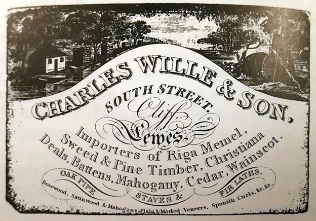
Charles Wille (1768-1849) occupied the Yard from 1800, owning it from 1805. He handed it over to his son Charles (1797-1878), before his death in 1849.
Wille senior had inherited his father’s builder’s and timber merchant’s business. He was a notable nonconformist and part-owned the plot of land on which was built The Tabernacle chapel, and he played a dominant part in its affairs. He was a prominent Lewes citizen taking a number of roles in the town. He lived in number 57 South Street, alongside his yard.
In 1843 a 75 ton ketch, Mary Ann, was launched from timberyard wharf, followed by an 182 ton brigantine, Harriet.
In 1853 Charles Wille junior retired and the yard was purchased by Chatfield and Sampson. In 1886 two large wharfs either side, frontage 200ft, depth 66ft were advertised for sale. In 1898 Wille Cottages were built on the site: see Houses section.
East Sussex Brighton and Hove Record Office [AMS 5569/26]
The Great Timberyard
This later became the site of New Row and Timberyard Cottages. In 1752 it included part of Bustwish (a wish was low-lying damp meadow) and was used as a wharf. Bought by W. Rice in 1760 and described in 1783 on Rice’s bankruptcy as ‘warehouse, saw house, great timber yard and wharf, also house‘ (number 30).
Smaller Timberyard
Also owned from 1765 by W. Rice, and described on his bankruptcy as ‘warehouse, timber yard and wharf, adjacent to river and separated from the Great Timberyard by a large sewer‘. Hillman Close now occupies this timberyard.
In 1784 a Sussex Weekly Advertiser report says that ‘W. Gaston has taken a convenient timber wharf… experience bargemen to Newhaven, also beach for turnpike roads, Newcastle and Sunderland coals & grindstones at his warehouse in Cliffe’.
Click image to enlarge
In 1788 the Great and Smaller Timberyards were bought by Edward Egles. Colin Brent in Georgian Lewes, p. 54 says: “… Cliffe draper, Edward Egles (1762-1838) attempted to manufacture cotton fabric in mid-Sussex, at the timberyard off South Street, at Hempstead Mill near Uckfield, and at Balcombe where wrought cotton muslin was stolen from a loom in 1793; but his efforts petered out before 1805”.
At his death in 1839 the estate of Edward Egle is described ‘as one of most convenient timber yards in the kingdom, entire two sides bounded by river Ouse, as also navigable cut from same through the centre, and two large warehouses, one formerly used as a cotton manufactury, and since for corn, etc.’ (Colin Brent House Histories, South Street citing Blaker A5120).
Evidence for the cotton mill is also shown at an examination in 1838 regarding a claim for poor law support, and reveals that Benjamin Hards said he had been hired in the late 18th century as a cotton spinner by Edward Egles and he had lodged in Cliffe Parish.

Click on image to enlarge
Timberyard Lane runs at an angle, just below the centre on the right hand side of the photo, between the timberyards and the row of low white buildings. The large timberyard is in the foreground, the small timberyard beyond, and a ship under construction on the lower left. Ships were built in the yards above the Cliffe Bridge (beyond Harvey’s) and the hulls were floated down at low tide under the Cliffe Bridge to be fitted out in boatyards off South Street
Gas works
The Lewes Gas Light & Coke Company was founded in 1822. It lay at the end of Morris Road, alongside the river with wharf for coal deliveries. A balloon ascent by Charles Green was made from the gas works in 1828 and was a notable event, bringing crowds to watch. He made a second flight a week later.
Three large gas holders (gasometers) were built on the large and small timberyards on South Street. The exact dates seem difficult to ascertain but the first gas holder was built on the small timberyard, alongside the river and just south of the gas works around 1869 and can be seen on the 1873 OS map. The second gas holder was built on the larger timberyard, alongside Timberyard Lane around 1879 and is depicted on the 1893 OS map. Around 1930 the first gas holder was disused and a third gas holder built behind Timberyard Cottages.
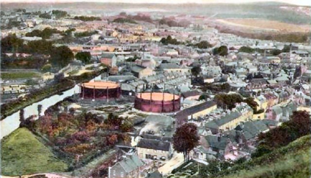
The 1950 OS maps shows only the two later gas holders and these remained until after 1963. Hillman Close and its houses and flats were built on the site in 1998, after remedial works to clear the pollution left by the gas.
A painting (dating from 1937?) by Eve Garnett shows the gas holders down Timberyard Lane and how they dominated the area. Eve Garnett wrote ‘The family from One End Street’ and lived in Lewes for some years.
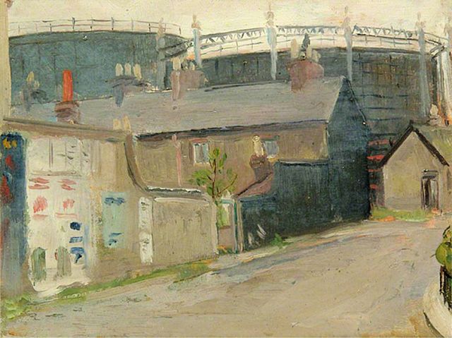
By kind permission of The Sussex Archaeological Society
Railway
Lewes’s first railway station opened in 1846 in Friars Walk. The line into the station ran across the water meadows opposite South Street.
The Friars Walk Station was superseded by a station on the present site in 1857. A marshalling yard covered a large area of the water meadows through which the line had originally run and 20th century residents remember the noise of shunting trains, which could be clearly heard.
Chalk Pit and Cement works
Chalk was dug from various pits around Lewes from earliest times, and these often included kilns for lime burning. On South Street there were two main pits, the Navigation Pit, which was behind the Snow Drop, now partially incorporated into the Tunnel entrance, and the Southerham Works Pit further south, now the Cliffe Industrial estate, which became a cement works in 1902.
The censuses show that there were at least eight chalkpit/lime burners resident on South Street by 1851.
Chalk was loaded into barges from the Navigation Pit behind the Snowdrop Inn. The cement works (Lewes Portland Cement & Lime Co Ltd) was in the next pit, from where cement was loaded by a crane on rail lines into a variety of vessel moored on the wharf, which extended from Wharf House southwards. Part of the wharf was the original location of Lewes Rowing Club in 1874.
When the new cement works opened in 1929 the older works site was demolished on both sides of the road (South Street was the A27). To the east side of the road, Gerald Gilmers Fencing occupied the north part of the pit and Chandlers Builders Merchants the south part. The road is now the A26. When the site was being prepared for the Rusty House (number 140) in 2014, excavations revealed rail lines, bricks, concrete rubble etc.
Cement works history:
1902-1906: Glover & Batchelor
1906-1929: Lewes Portland Cement and Lime Co. Ltd
1929-1962: Eastwoods Ltd
1962-1979: Rugby Portland Cement Co. Ltd
1979-1981: Rugby Group

(Image appeared in Lewes History Group Bulletin, 12, 2 July 2011)

With kind permission of Tom Reeves
This photograph shows works being carried out by W.T. Henley’s Telegraph Works, which dealt in electrical, telephone and telegraph cables. They are working on the site of the present Rusty House (no. 142) and Wharf House (no. 138) can be seen behind. The bridge on the upper right-hand side was used to bring barrow loads of chalk from the chalk pit behind to be tipped into barges moored at the wharf.
A more colourful view of the Cement Works is shown in two paintings by the Bloomsbury Group artist, Duncan Grant. These were painted from South Street.
Chalkpit, Lewes(1951) is owned by Southwark Art Collection: (below)

Lewes Landscape (1933-1934) is owned by Leicester Museum and Art Gallery, and depicts Southerham chalk pit east of the Ouse under Mount Caburn, south-east of Lewes, East Sussex.